BRIDGES TO PROSPERITY
Trail bridges designed with AutoCAD deliver 6x economic activity for communities in Rwanda
AutoCAD Success Story
Share this story
Creating new paths for opportunity
With AutoCAD, Bridges to Prosperity designs cost-efficient, long-lasting trail bridges that connect residents to education, healthcare, and economic opportunities – returning at least 6x the bridge cost in increased economic activity.

Discover more about Bridges to Prosperity and their use of AutoCAD. Video courtesy of Bridges to Prosperity.
Transforming communities with trail bridges
More than 1 in 7 rural residents struggle to reach markets, jobs, schools, and healthcare because of a lack of connectivity. One solidly constructed and safe trail bridge can transform a rural community. Children can easily attend school. Food and products can be transported to the market. Residents can access doctors and healthcare. A community can flourish and plan for its future.
But how do you design and install a bridge in some of the most remote areas of the world? That’s where Bridges to Prosperity comes in. For the past 22 years, the organization has focused on building trail bridges worldwide to help end poverty due to rural isolation. To date, they have built more than 500 bridges that serve more than 1.5 million people globally.

Etienne Mutebutsi on the Marenge Bridge. Courtesy of Bridges to Prosperity.
One trail bridge saves hours of walking
Take the Marenge suspended trail bridge for example. It’s a steel suspension bridge located near the capital city of Kigali, Rwanda and now connects a community of more than 3,000 residents from the Nduba Sector.
The former bridge was made of timber and washed away annually when the river flooded. Prior to Bridges to Prosperity’s construction of the Marenge Bridge, community members had to find alternative crossing points further upstream. This significantly increased travel time and made the journey daunting in the mountainous region. Community members carried food and walked for hours along the river to reach the main road to Kigali to go to the market or attend school.
After the installation of the new trail bridge, the distance and travel to the markets and schools has been reduced by a minimum of 50%. And it all comes with new economic opportunities thanks to this seemingly simple yet vital infrastructure.
“The suspended trail bridge in Marenge helps the community to have access all-year round. The community won’t have to struggle to maintain the bridge every year or every rainy season. Now they can actually cross safely on a daily basis.”
—Etienne Mutebutsi, Needs Assessment Manager, Sub-Saharan Africa, Bridges to Prosperity
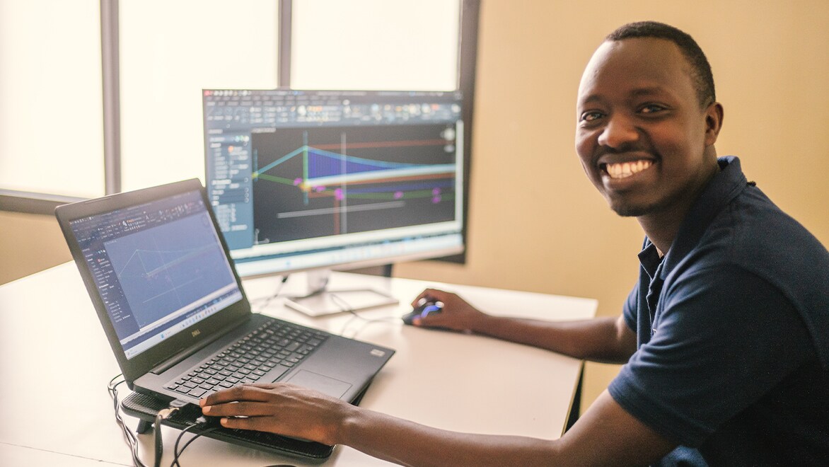
Etienne Mutebutsi and trail bridge design in AutoCAD. Courtesy of Robb Hohmann Photography.
Designing trail bridges with AutoCAD
Etienne Mutebutsi first joined Bridges to Prosperity 10 years ago, right out of college with his civil engineering degree from Integrated Polytechnic Regional Center (IPRC-Kigali) in hand. Bridges to Prosperity had recently started operations in Rwanda and partnered with the university to provide training to build pedestrian bridges. After completing an internship in 2013, he began working as a project engineer. He started performing topographic surveys for bridge installations and learned how to use AutoCAD to make profiles and preliminary designs.
“The organization is large and based in Denver, but at the time we were a small team here in Rwanda with only two engineers,” Mutebutsi says. “Here, we could start making structural drawings in AutoCAD and share them with the director of engineering to review and finalize the drawing.”
With AutoCAD, the Bridges to Prosperity team in Rwanda continues to easily share the vision and impact of a new trail bridge with key partners, governments, and communities. “AutoCAD and the drawing itself actually help us to convince or even actually make our work more transparent,” Mutebutsi says.
“Bridges to Prosperity uses AutoCAD because it's a powerful tool for making clean drawings. Taking topographic survey data, the team can process it to create precise profile drawings. And you can share the document with your colleagues so everyone can collaborate in the same drawing.”
—Etienne Mutebutsi, Needs Assessment Manager, Sub-Saharan Africa, Bridges to Prosperity

Courtesy of Bridges to Prosperity
Using AutoCAD with the help of the Autodesk Foundation
Since joining the Autodesk Foundation's portfolio in 2020, Bridges to Prosperity has utilized the full spectrum of in-kind support, including Autodesk software, technical training, and pro bono consultants to advance its mission.
All 500+ bridges completed to date throughout the world were designed in AutoCAD, from start to finish. The average trail bridge project costs approximately $100,000, taking into consideration varying topographic and geographic conditions, community contributions, and logistical challenges. The efficiency of using AutoCAD combined with supply chain management and local support helps keep the cost low, while providing this vital infrastructure for new economic opportunities.

Courtesy of Bridges to Prosperity
Designing three bridge models with AutoCAD
The organization has three types of bridge models that are chosen based on topography: a suspended trail bridge, a suspension trail bridge, and a hybrid of the two. If crossing a river, the design used is determined by the shape of the river valley and to ensure the bridge deck is raised and the highest water level doesn’t wash away the bridge during the rainy season. Local materials are used as much as possible, including cement, sand, gravel, rock, re-bars, fence, and steel profiles for the decking. With these designs created in AutoCAD, the team can fine tune and adapt to the environment and individual challenges of a site.
The community is an integral part of the process and transparency as well. After all, it is their home. The drawings are also posted in the community so residents can ask questions and understand how the bridge will look and serve their needs.
Adopting new tools and technologies to scale
For Mutebutsi, the impact of these remote infrastructure projects is immense. Scaling growth is critical to connecting the 250 million that can’t reach basic resources due to an impassable river. He’s excited about the latest developments in technology happening right now.
This is especially true with Fika Map—a new suite of remote analysis tools created by Bridges to Prosperity that will make his current job as a needs assessment manager easier and create even more opportunities for infrastructure investment. Fika Map was supported by the Autodesk Foundation through funding and pro bono consultants to help support the development.
Fika Map is revolutionizing geospatial data with the use of artificial intelligence to scale bridge building by conducting site identification, bridge type assessment, and post-build impact analysis remotely. By harnessing publicly available data, it identifies transportation barriers in rural, hard-to-reach regions. This directly impacts these communities by empowering local decision-makers with actionable insights, ensuring resources are optimally allocated to build critical infrastructure where it's needed most.
"With the support of the Autodesk Foundation, we're able to scale our growth to help connect first mile communities and expand our systems change approach to more geographies."
—Abbie Noriega, Chief Impact Officer, Bridges to Prosperity.
Discover the power of AutoCAD
Speed up and streamline your workflow with a subscription to AutoCAD including specialized toolsets.