CITY OF STRASBOURG
How the Strasbourg Eurometropolis is gradually succeeding with its transition to BIM
THE FUTURE OF MAKING
Share this story
Digitization and town planning
The Strasbourg Eurometropolis is made up of 33 municipalities spanning an area of 340 km². The Service of Geomatics and Territorial Knowledge is working on producing a geographical database which, as well as being standardized and highly accurate, must be immediately accessible to the municipalities.
“There is a need for increasingly greater knowledge of the city’s natural and built features among business administration services such as the road, sanitation, and environmental departments, but also for citizens, the climate, and to take advantage of the potential of the latest technology in project approaches.”
—Philippe Slisse, 3D GIS Project Manager, City and Eurometropolis of Strasbourg
Bringing aerospace technology to construction materials
This service is cross-sectoral in order to facilitate feasibility studies and 3D design for urban redevelopment, provide decision-makers with background information, and also to simplify interactions during public meetings with citizens.
Text-only; 1 column
To this end, the City’s administration and the Strasbourg Eurometropolis have chosen to work with the BIM (Building Information Modeling) tools of Autodesk, including InfraWorks, and Revit.
“With InfraWorks, I discovered an efficient tool which was quite easy to use and helped me meet the requirements of business services in a way that is well-adapted to the design phases,” says Slisse.
What is the result? “Today, we have an accurate representation of the physical features of the area with a precision of 5 cm which provides all business services access to the existing conditions data they need for their projects and managing their assets,” Slisse explains.
A boost for 3D
A 3D GIS project unit was created in 2014 in order to facilitate the use of 3D technology in the city’s urban projects and make the data available to the public.
Its first task was to transform the 2D repositories into 3D repositories. The transition took place thanks to data being generated in the form of a scatter plot, a 3D textured model (PhotoMesh), and a 3D semantic digital model.
“Airborne LIDAR data collection allowed us to produce a scatter plot with a density of 20 points/m² and a precision greater than 10 cm, which is very rich in detail. Today, our existing conditions database is enriched by 3D technology and our updates are carried out entirely in 3D, which was not the case two years ago,” Slisse points out.
Text-only; 1 column
The 3D GIS project unit “currently supports business users in their direct and concrete uses of BIM data, including during district redevelopment projects carried out as part of the urban renewal program.”
An objective that the Geomatics Service and the 3D GIS unit are achieving thanks to increased competency in Autodesk tools.
“At the beginning, we started working on 3ds Max. We were focusing for the most part on producing rendered images or visualizations,” says Slisse.
“Then, with the discovery of InfraWorks and all its potential, we were able to get more involved upstream and could then help with design from the beginning of the project.”
Generating documents to assist with decision-making
The Eurometropolis also takes a co-construction and consultation approach in which municipalities intend to give citizens a larger role and involve them in the projects to be undertaken.
The Pact for Democracy in Strasbourg, signed and adopted at the municipal council in 2018, guarantees the rights of citizens to information, consultation, collaboration, and the co-construction of projects. In this context, the local administration is committed to implementing a digital platform for citizen participation made up of the geographic data.
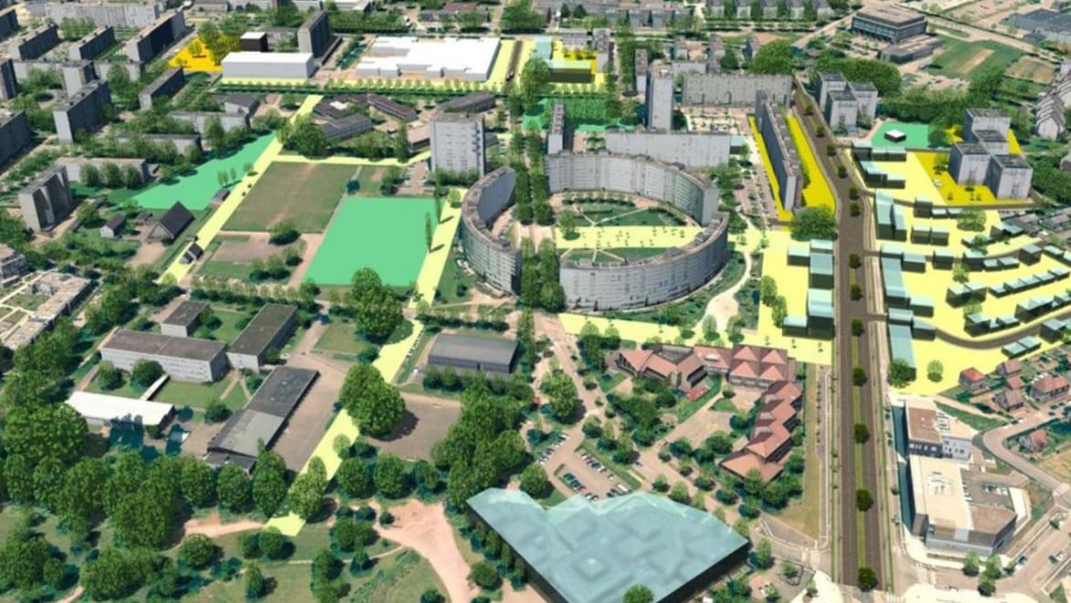
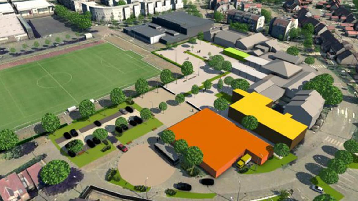
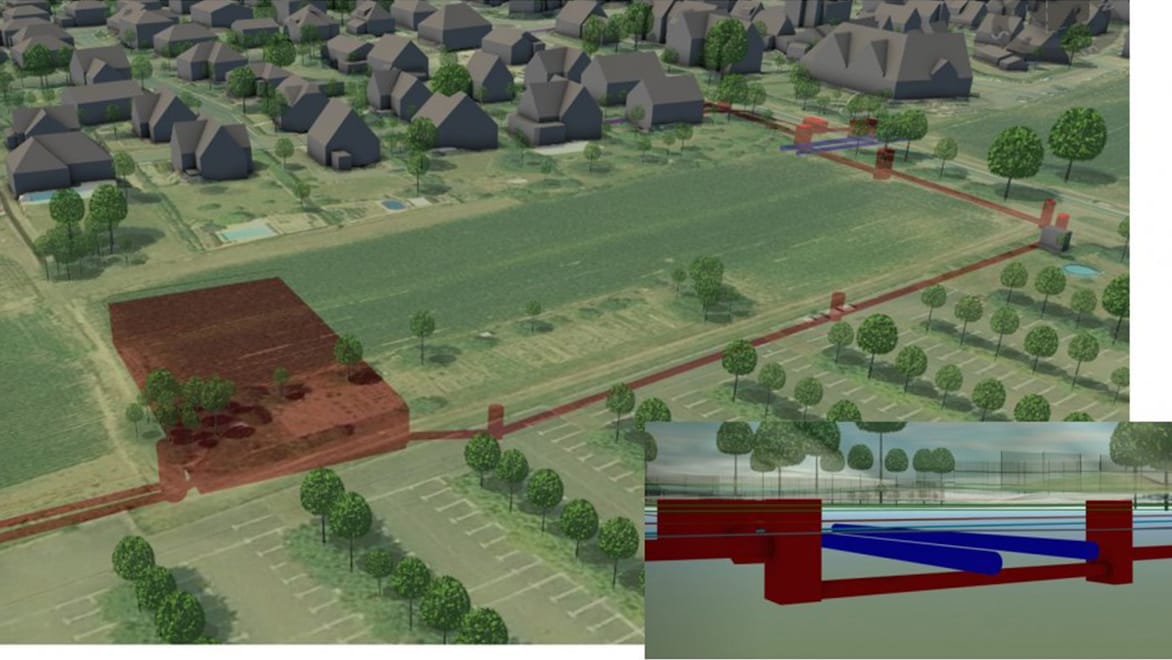
The Geomatics Service has thus relied on business teams which, thanks to InfraWorks and BIM integration, have helped all the collaborators understand how certain developments can be brought together in the territory.
Text-only; 1 column
This visualization of town planning projects lets us analyze and explore different options for each project even before taking action, with this process being even quicker than before.
Furthermore, InfraWorks offers all the participants involved a shared database of 3D data, which is always available and easily interpretable. It greatly accelerates the progress of the town planning projects and helps reduce rounds of feedback and improve quality. Business services can also add information concerning their projects to the database without the need for external help, therefore updating it in real time.
The 3D data is made available to the public, online, and via the Open Data platform (data.strasbourg.eu) of the City and Eurometropolis of Strasbourg.
Town planning of the future: more informed, shared, and effective
Autodesk’s BIM tools are pushing the transition to 3D Geographical modeling, offering various benefits to the users.
“Today I’m using the automation scripts and workflow options available via InfraWorks. This means I avoid manual work which allows me to concentrate on activities which could bring real added value to the teams.”
—Philippe Slisse, 3D GIS Project Manager, City and Eurometropolis of Strasbourg
Text-only; 1 column
In fact, Slisse estimates that using automation scripts is saving him considerable time compared to the past.
"Today, I can offer a 3D image of everything that exists across the territory in half a day instead of two days,” he is happy to say.
City of Strasbourg
This is not the only achievement: following the introduction of InfraWorks by the 3D GIS team, geomatics specialists, engineers, and employees of the Eurometropolis’ technical departments have, for their part, steadily experienced the benefits of the software in terms of control, visualization, and communication in the context of their projects, even when they are not directly linked to BIM or 3D.
Moreover, this transition to 3D technology also benefits private engineering firms.
“From the feasibility study phase, the engineering construction department designs all the projects in 3D with AutoCAD and InfraWorks. Architects and private design consultants also benefit from 3D knowledge of the territory which is available in Open Data and can be integrated into BIM software such as Revit. As well as time savings, there is also financial gain, because instead of sending teams to conduct topographical surveys, they can use the 3D data produced by the Eurometropolis. At the end of the project, we hope to receive the 3D models in return so we can update our reference data.”
Text-only; 1 column
According to Slisse, we are witnessing an essential transition for the community:
“3D and BIM are there to make people think differently about how to design and manage their projects. Now it is up to us to accelerate the move to 3D and assist business services in increasing core competencies for the future of geomatics, citizens, and the territory.”
—Philippe Slisse, 3D GIS Project Manager, City and Eurometropolis of Strasbourg
Extend the value of BIM
Learn how industry leaders, trade organizations and government officials are working together to meet increased demands for infrastructure projects.