Point clouds

Point clouds: empowering industries, inspiring the future

Discover the diverse applications of point clouds across industries, from architecture and engineering to virtual reality and autonomous vehicles.

What are point clouds?

A point cloud is a set of data points in a three-dimensional coordinate system. Each point in the cloud contains multiple measurements, including color and luminance, as well as its position along the XYZ axes.

How point clouds are produced

Point clouds start with data gathered from 3D scanning technologies like LiDAR (Light Detection and Ranging) or structured light scanning. LiDAR systems emit laser beams in a space and measure the time it takes the beams to reflect back. This information can be used to create a point cloud that accurately represents the structures and surfaces in the scanned area.  

The accuracy of the 3D models produced from point clouds makes them a valuable tool to many industries. In architecture, point clouds help capture the current conditions and layout of a building, while measurement data is vital for construction and restoration projects. In the world of manufacturing, 3D models powered by point clouds allow product refinement and production at scale.

Benefits of point clouds

The use of 3D point clouds contributes to improved accuracy and efficiency across industries.

Accurate representation

Point clouds offer an accurate and detailed 3D representation of a scanned environment or object.

  • Capture precise spatial data
  • Aid visualization and analysis

Comprehensive data capture

Point clouds capture a large amount of complex data in a single scan.

  • Efficient information gathering
  • Easier measurement and modeling

Nondestructive data acquisition

Scanning techniques like LiDAR enable nondestructive data acquisition.

  • Scan objects without touching them
  • Analyze hard-to-reach spaces

Time and cost efficiency

Using point cloud software saves time and budget compared to traditional methods.

  • Eliminate physical reconstructions
  • Skip the manual measurements

Enhanced visualization and communication

Point clouds can facilitate visualization of spaces and collaboration among stakeholders.

  • Create as-built 3D models
  • Allow for walkthroughs and simulations

Precise measurements and analysis

Point clouds accurately measure distances, volumes, angles, and other geometric properties.

  • Support detailed analysis
  • Make inspection more efficient

Data preservation and documentation

Point clouds can serve as a digital record of the scanned object or environment.

  • Enable historical preservation
  • Create a permanent data set

Interoperability and compatibility

Point clouds can be integrated with many software applications and workflows.

Industries using point clouds

Architecture, engineering, and construction (AEC)

AEC industries use point clouds to create accurate as-built models of existing buildings, infrastructure, and sites.


Geospatial and surveying

Point cloud scanning plays a vital role in terrain modeling, topographic mapping, and pond design.


Manufacturing and product design

Point clouds support efficient collaboration for digital factory design and modeling.


Entertainment and media

Point clouds power the virtual environments in augmented reality, virtual reality, and video games.


Image courtesy of Homologue

Software for point clouds

Reality capture and 3D scanning software and services


BIM 360 is a construction management platform that connects, organizes, and optimizes projects from design to construction.


Plan, design, construct, and manage buildings with powerful tools for Building Information Modeling.


2D and 3D CAD tools, with enhanced insights, AI-automations, and collaboration features. Subscription includes AutoCAD on desktop, web, mobile, and seven specialized toolsets.


Civil engineering design and construction documentation


3D modeling, animation, and rendering software for games and design visualization


See what Autodesk software can do

Art Graphique & Patrimoin

Using point clouds for restoration and preservation

Autodesk and Art Graphique & Patrimoin captured 3D scans and used point clouds for the restoration of Notre-Dame de Paris Cathedral.


Grand Egyptian Museum

Managing and protecting ancient artifacts with point clouds

The Grand Egyptian Museum uses point clouds to complete construction and maintain antiquities.


BUREAU OF RECLAMATION

Maintaining critical infrastructure with point clouds

Photorealistic 3D point clouds help Bureau of Reclamation identify risks and opportunities at the Glen Canyon Dam.


Point cloud resources

Discover the benefits of real-time data, from improving cross-team collaboration to project management.

Learn how BIM is changing the architecture, engineering, and construction (AEC) industry.

See how digital collaboration is fueling the restoration of a historic New Zealand church.

Frequently asked questions (FAQs) on point clouds

How are point clouds generated?

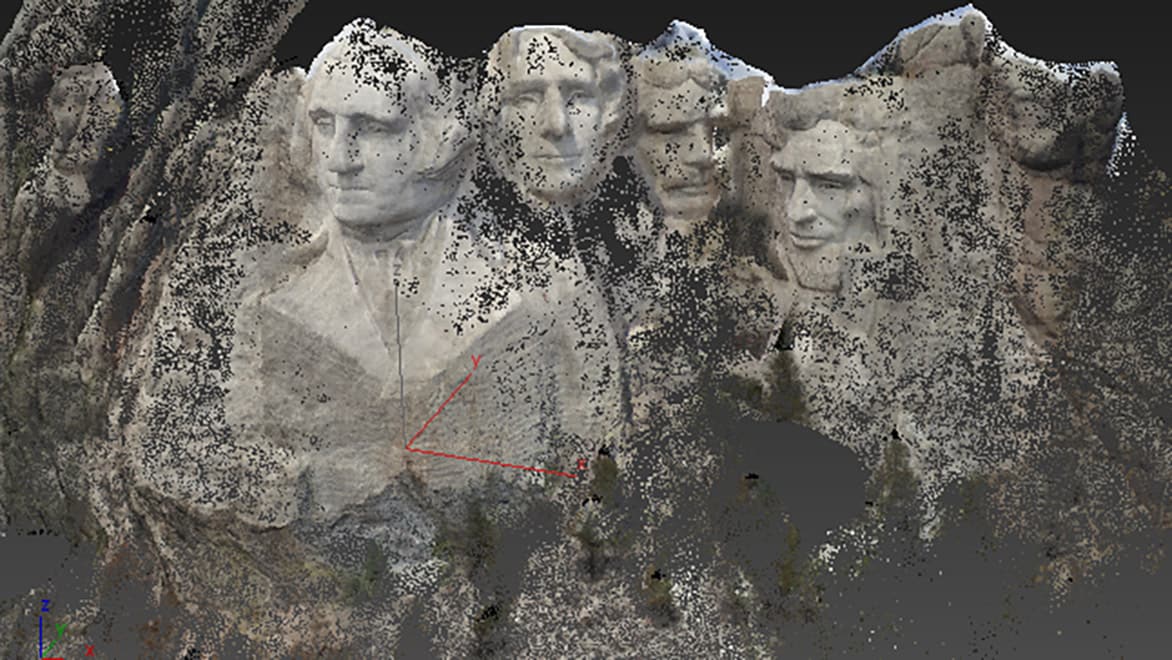
Point clouds are generated with scanning and sensing technologies and methods like LiDAR, structured-light scanning, time-of-flight cameras, sonar, radar, and photogrammetry. These methods capture data about the geometry and spatial information for objects and environments by measuring distances, light patterns, or wave reflections. The captured data is then processed and converted into a set of 3D points, each based on a specific position in space. Post-processing steps are often taken to refine the data, improve its accuracy, and translate it across trades and applications.

What is a point cloud used for?

Point clouds can be used for a variety of purposes, primarily in industries like architecture, engineering, construction, entertainment, forensics, geospatial mapping, manufacturing, and robotics. They offer a detailed 3D representation of real-world objects or environments, enabling complex tasks like as-built modeling, reverse engineering, virtual-reality experiences, precise measurements, and data visualization. The use of point clouds makes many nuanced processes much more efficient, making them a versatile tool for capturing, analyzing, and using 3D spatial data.

What is an example of point cloud data?

An example of point cloud data is the representation of an object or environment captured using laser scanning technology or photogrammetry. Consider a building: To create a 3D point cloud of a building, a 3D scanner could be used to capture multiple data points and perspectives. Each point would represent a specific location in the building’s structure. The data points collected are then combined to form a point cloud that represents the 3D geometry of the building. In essence, point cloud data is any information gathered via laser scan or photogrammetry, then used to create the point cloud.

What is the difference between point cloud and photogrammetry?

The difference between a point cloud and photogrammetry is in the way the data is captured and represented. A point cloud is a set of 3D points that represent the geometry of an object or space. Point clouds are typically generated using scanning technologies like LiDAR, or image-based methods like photogrammetry. Photogrammetry involves capturing multiple images of an object or environment from a variety of angles, then using software to calculate dimensions and plot precise points in 3D space.

What is the difference between point clouds and mesh models?

A key difference between point clouds and mesh models is found in their digital representation and data structure. Point clouds are collections of individual points depicted in 3D space. Each point represents a specific location and can contain additional information like color or intensity. In contrast, mesh models are surfaced-based representations built from interconnected polygons like triangles or quadrilaterals. They provide a closed surface that approximates the shape of the object, with edges, faces, and vertices defining its structure. Point clouds retain the raw data and details, while mesh models offer a more compact and structured representation.

How accurate is a point cloud?

Point-cloud accuracy can vary based on the technology used for data capture, the scanning setup, and the data processing methods applied. Advanced scanning technologies like LiDAR can achieve sub-centimeter, or even sub-millimeter accuracy, while other methods may be slightly less precise. Factors like sensor limitations or movement within the scanned space can impact point-cloud accuracy as well. Accurate point clouds are often produced from multiple scans, and a thorough quality control process can minimize errors and ensure data is gathered effectively.

See more FAQ