SCAN TO BIM

Scan to BIM: Reality capture meets actionable data models

Bring more accurate, efficient automated processes to building and site documentation.

Architects work on digital models on their computers.

Architects work on digital models on their computers.

What is scan to BIM?

Scan to BIM is a workflow or process that translates laser-scanned, point-cloud digital models into building information modeling (BIM) platforms that interpret the data and integrate it into a 3D site or building model for development, design, and construction teams. These rapidly assembled models offer visual accuracy and granular spatial awareness. Automating most of the building documentation and reality capture process is useful for documenting the site on new construction projects and to gain a deep understanding of existing infrastructure on renovation or adaptive reuse projects.

A laser scanner measures space on a construction site.

A laser scanner measures space on a construction site.

How scan to BIM works

The scan-to-BIM process translates the visual, spatial appearance of a building or site and organizes it into a legible model filled with actionable data in a matter of hours. This positions it to replace many fundamental building and construction tools, down to the humble tape measure. Scan to BIM is akin to 3D photogrammetry and, depending on how you experience the 3D model, is related to augmented reality (AR).

The scan-to-BIM workflow begins with a laser scanner that can be attached to an aerial drone, affixed to a stationary tripod, and moved from place to place, or the scanner can be clipped to a person as they move around a site. The laser scanner records points in space corresponding to the geometry of the site—including walls, doors, the ground plane, apertures, and more—tracking each point’s position along its xy, and z axes.

The resulting point-cloud contains immense amounts of data. Some scanners can collect 2 million unique points every second and 600 million points during a five-minute scan. The laser scanner ascertains the location of these points by sending out a light beam and measuring the distance it takes to bounce back and return. Lidar (Light Detection and Ranging) is the primary scanning method, though some scanners use SLAM (Simultaneous Localization and Mapping) algorithms that can determine the location of the scanner while the point-cloud map is being assembled.

A structure is represented as a point cloud onscreen.

A point cloud is displayed in Autodesk ReCap.

Creating and using the model

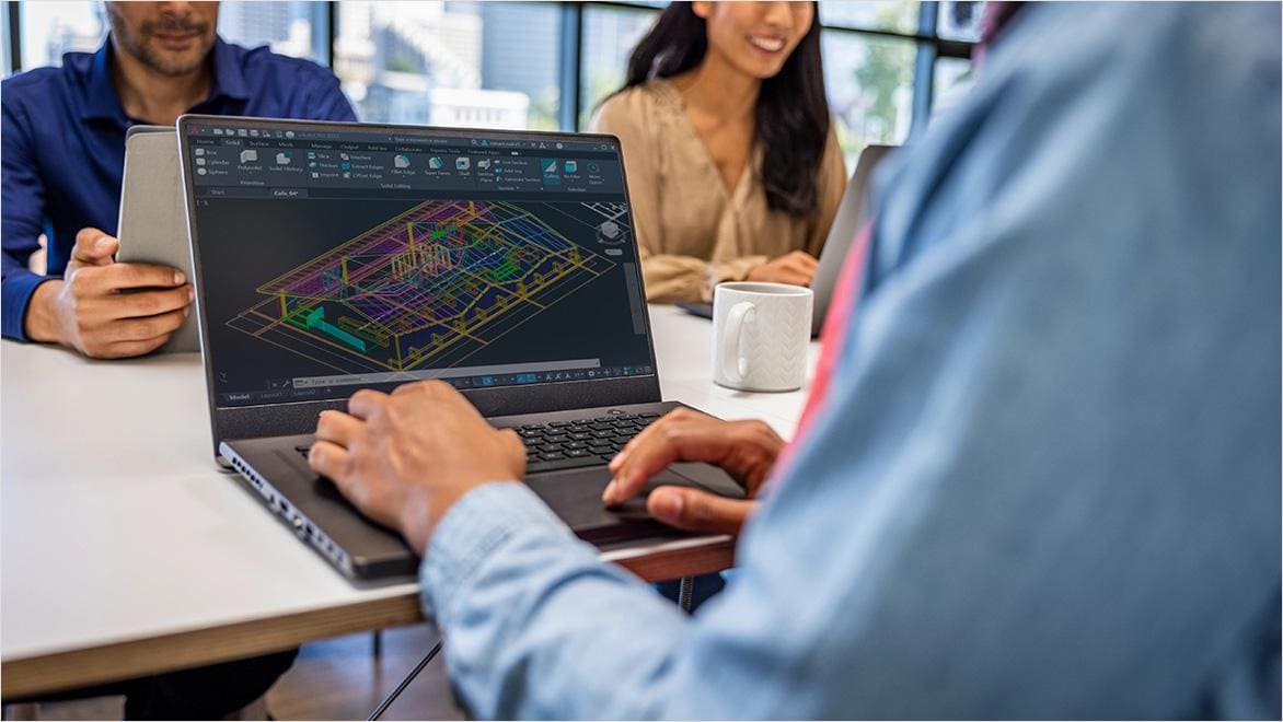
Millions of points define every surface of a building or site and require some level of manual or automated interpretation to become a usable model. Some modeling tools have the user trace over the point cloud to define individual elements, which can be useful for custom detailing, idiosyncratic building features, or historic preservation. Other tools automatically analyze the point cloud to organize the geometry of the building or site. Autodesk ReCap Pro reality-capture software interprets point-cloud data and makes it usable in Autodesk Revit.

Once a point cloud is uploaded into design software such as Revit, some data-cleaning oversight can filter out errors, like a reflection on a window interpreted as a real object or a builder that briefly walked through the frame. The ultimate deliverable from the 3D scan-to-BIM workflow is a point cloud embedded with metadata that design and construction teams can access to plan and revise the project.

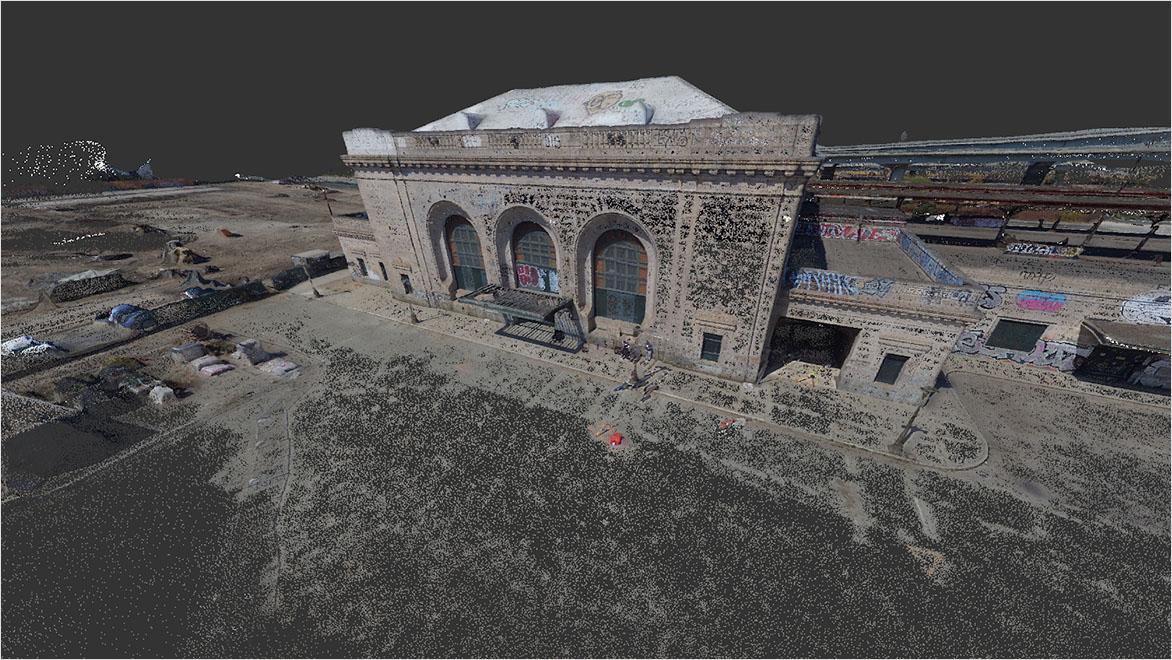
The scan-to-BIM process can improve speed, accuracy, and workflow across all design and construction processes. Potential clients can use scan-to-BIM workflows to assess sites for development or buildings for renovation. Teams can use scan-to-BIM workflows to select an ideal site from a larger parcel and can determine how to manage factors such as zoning regulations (access to parking or transit, height limitations, and so forth) before engaging a designer. Architects and designers can use the models to craft designs using high-quality data on decades-old buildings. And builders can use the models to monitor construction progress to hew closely to the design.

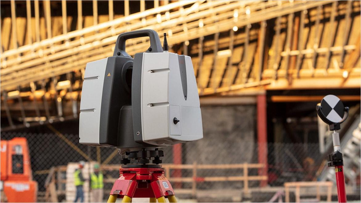
Because these scans take just hours to gather and interpret, the process can be repeated as necessary during the construction phase. The ease of scanning also helps facility-maintenance crews complete inspections and identify needed repairs, especially in places that are dangerous or difficult to physically access.

Benefits of scan to BIM

Speed

Depending on the level of detail required, a scan can cover 100,000 square feet of space per day. Once the point cloud is captured, it can be processed via cloud computing in hours.


Accuracy

The highest levels of detail available in scan-to-BIM processes offer a tolerance range of a single millimeter or less. With embedded metadata, this measurement is accurate enough to fabricate carbon copies of the building feature being scanned.


Historic preservation

Scan-to-BIM modeling can be especially useful on historic preservation projects. Preserving and replicating historical details is crucial for funding such projects; this process can mitigate outdated or inaccurate blueprints, common in old buildings.


Autodesk software for scan-to-BIM projects

Reality capture and 3D scanning software and services


Plan, design, construct, and manage buildings with powerful tools for Building Information Modeling.


Cloud-based design co-authoring, collaboration, and coordination software for architecture, engineering, and construction teams. “Pro” enables anytime, anywhere collaboration in Revit, Civil 3D, and AutoCAD Plant 3D.


Customers exploring scan to BIM

A photo of a curved brick surface shows weathered details.

CHINA CONSTRUCTION FIRST GROUP

Safekeeping artifacts

Construction management company China Construction First Group used drone laser scanning and ReCap to plan construction routes safe to transport priceless artifacts through the historic infrastructure of China’s Jingdezhen Imperial Kiln Museum.


A photograph of an electrical substation shows scaffolding and transformers.

ATTF

Minimizing site exposure

French reality-capture company ATTF creates laser-scanned point-cloud models of nuclear sites, autonomous industrial utilities, and other extreme environments, using scan-to-BIM processes to minimize site exposure to help ensure worker safety.


China's supertall Tianjin Chow Tai Fook is shown under construction.

CCEED

Rethinking skyscraper construction

China Construction Eighth Engineering Division used point-cloud models and ReCap to model the massive structural steel members used in the 1,700-foot-tall Tianjin Chow Tai Fook Financial Center skyscraper and help ensure more precise assembly.


Image courtesy of China Construction Eighth Engineering Division

Scan-to-BIM resources

A guide to getting started with scan to BIM using a Leica BLK360 laser scanner, ReCap Pro, and Revit.


An architect and a reality-capture specialist explain how to verify the accuracy of scan to BIM at each step in the process.


This presentation covers scan-to-BIM basics, such as defining the scope of work, the required level of definition, the types of risk, and more.


Frequently asked questions (FAQs) on scan to BIM

What is BIM?

BIM (building information modeling) is a continually updated digital model of an existing building, building under construction, or intended building design. Depending on the level of detail, this model is embedded with information about its individual elements, what they’re made of, and how they function. BIM is used by architects to refine designs and by builders to monitor construction progress.

What is the difference between scan to BIM and BIM?

Whereas a building information model is a discrete digital product, scan to BIM is a process that leads to the creation of this model: a detailed laser scan and a point cloud array that can be translated into a building or site model.

How is BIM different from CAD?

CAD is a general-purpose drawing tool used by various industries, and BIM is specifically used for design and construction, creating models with richer levels of data, including information on materials, thermal or acoustic properties, sustainability, and more.

How is scan to BIM used in land development?

For prospective building sites, scan-to-BIM modeling can create detailed models of precise ecological conditions, as well as surrounding infrastructure or neighboring buildings. This could include how a stream bank will erode during a torrential downpour, how elevation changes might affect weather patterns or access to light, how shade will determine solar heat gain, how to efficiently dig a water-detention basin to fit the natural topography, and more.

See more FAQ