Land Surveying Software

Autodesk makes surveying software for land surveyors, civil engineers, project managers, and construction professionals.

Two engineers use their equipment to survey land at a job site.

What is land surveying software?

Land surveying software assists in the process of evaluating a 3D landscape to determine the angles and distances between a series of points. Measuring the positioning of these points is typically used to establish maps and boundaries for buildings and other subterranean civic projects. 

A locally employed surveyor at an open-pit copper mine in Zambia

How does land surveying work?

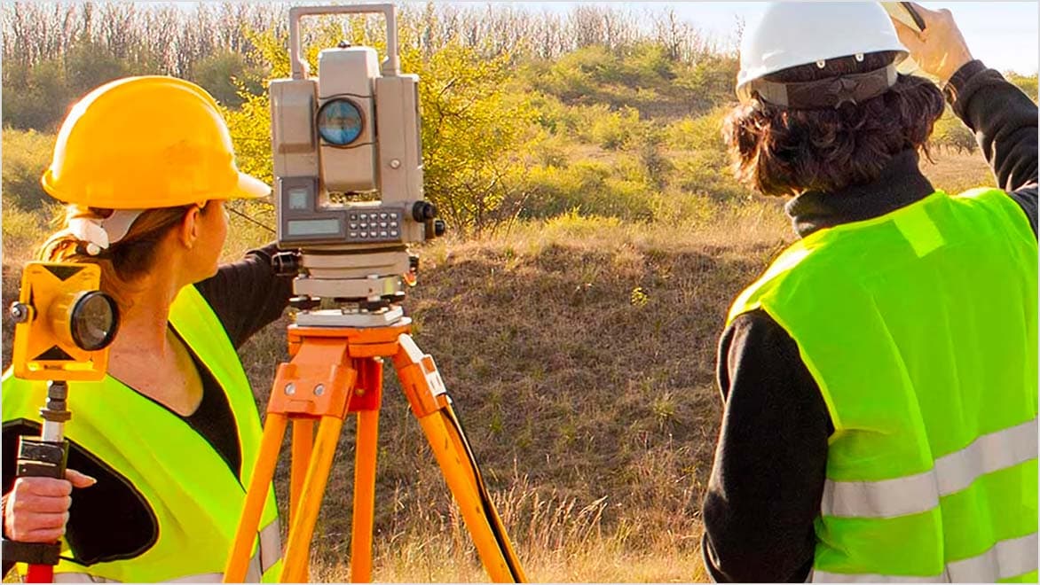
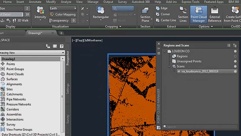
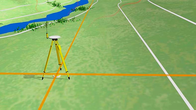
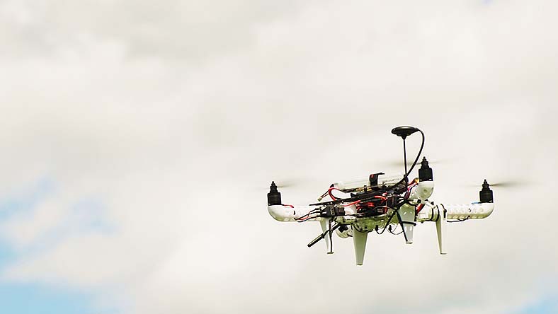
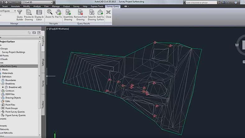
Land surveyors use a variety of tools, such as total stations (which use beams of light and built-in electronic distance measurement to collect data and triangulate positions), GPS devices, theodolites, drones, retroreflectors, 3D laser scanners and other technological devices. Surveying also utilizes knowledge and practices from many different fields, including trigonometry, geometry, engineering, and physics. Today, the data and measurements collected by surveyors in the field can be fed into surveying software to generate precise calculations, visualizations and more. 

Methods of land surveying

While there are many different land surveying techniques, there are three fundamental ones that are used the most often. These three techniques can be used alone, or in combination with each other.

Plane surveying

Plane surveying

One of the more commonly used surveying methods, this assumes that the earth is a flat surface and disregards its curve.

Geodetic surveying

Geodetic surveying

Used for surveying large areas, this method takes the curvature of the Earth into account.

Aerial surveying

Aerial surveys

Data is collected from above via drones, planes, and other aircraft.

Featured land surveying software

Powerful BIM and CAD tools for designers, engineers, and contractors, including Revit, AutoCAD, Civil 3D, Autodesk Forma, and more


Civil engineering design and construction documentation


2D and 3D CAD tools, with enhanced insights, AI-automations, and collaboration features. Subscription includes AutoCAD on desktop, web, mobile, and seven specialized toolsets.


BIM 360 is a construction management platform that connects, organizes, and optimizes projects from design to construction.


Plan, design, construct, and manage buildings with powerful tools for Building Information Modeling.


Navisworks Manage, Navisworks Simulate software and the Navisworks Freedom 3D viewer for 5D analysis, design simulation, and project review.


See how customers are using land surveying software

Morocco's Bouregreg River bridge

EGIS

6 Firms, 3 Continents, 1 Bridge

Building Africa’s longest and tallest cable-stayed bridge in Morocco brought together 6 companies to collaborate across 3 continents.

Model of the new WWTP Zimmerberg

HUNZIKER BETATECH AG 

Modernizing aged water infrastructure

The engineering firm was tasked with combining two aged wastewater treatment plants at one location. A task that could only be accomplished using BIM. 

A section of the Havelland Autobahn being extended

WAYSS & FREYTAG INGENIEURBAU AG 

BIM in the fast lane: the Havelland Autobahn extension

The Autobahn is among the BIM pilot projects of the government's 2020 road map. The route will be widened to six lanes while traffic will remain open. 

Land surveying software tutorials

The Hitchhiker’s Guide to AutoCAD

 The Hitchhiker’s Guide to AutoCAD Basics

This guide introduces you to the essential commands that you need to create 2D drawings in AutoCAD 

Surveying Project in Civil 3D

Survey tutorials in Civil 3D

Uncover the guide to the basic commands needed to create and modify surveys in Civil 3D. 

Tour of AutoCAD UI in AutoCAD

 Getting started with AutoCAD

Explore the video series on getting started in AutoCAD.  

Land surveying resources

See how the AEC Collection is used to for civil/survey consulting processes, proposals, and workflows.

Discover how to use AutoCAD Civil 3D for various day-to-day operations of consulting engineering and surveying companies.

See how BIM is used to survey and map the world's largest twin-helix steel structure.

Use 5 real-world examples to help you to understand survey functionality within AutoCAD Civil 3D software.

Learn how to create a model from external survey information, how to manipulate surface data, and process multiple survey data into one model.

Get access to the latest news, tutorials, and resources on civil infrastructure.

Frequently Asked Questions

What are the two basic principles of surveying?

The first basic principle of surveying is that the position of any given point should be ascertained by measuring from at least two other reference points. The second is to work “from whole to part” – when surveying, the whole area to be surveyed should first be established with precision, using control points.  

Why is land surveying important?

Land surveying is important for several reasons. It creates the legal basis and evidence for land ownership and can be used to settle property disputes. It is also vital in determining and planning the positions of new constructions such as roads and buildings and makes it possible to gather detailed knowledge and maps of large areas for a variety of purposes. 

Do land surveyors use CAD software?

Land surveyors make extensive use of computer-aided design (CAD) software, as it allows them to accurately visualize and present information on the areas they are surveying. CAD modeling enables them to produce a virtual representation of the features of buildings, landscapes and more. It can even show how future construction and improvements will alter the area. CAD software is considered particularly flexible and time-efficient, as changes can be easily made at any point. It can also lead to greater accuracy. 

How is laser scanning used in land surveys?

Laser scanning is a popular land surveying method that can accurately measure and collect data from objects, surfaces, buildings, and landscapes. Modern laser scanners can collect detailed point clouds, and with point cloud processing software, these datasets can create digital 3D models of the scanned environment. 

What are the different types of land surveying?

There are myriad types of land survey, including:

  • ALTA/ACSM survey—a land title survey for residential and commercial properties which includes details of property boundaries, land improvements, encroachments, and many other features.
  • Boundary survey—used to define the boundaries of a property or piece of land.
  • Construction survey—used to inform the construction of buildings, roads, and other structures.
  • Location survey—identifies the location of improvements on a piece of land in relation to property boundaries.
  • Site planning survey—commonly used to obtain planning permission, and include locations of existing buildings, proposed improvements, and natural features.
  • Subdivision survey—required when dividing a piece of land into smaller separate parcels.
  • Topographic survey—identifies natural and man-made features within an area in detail.

Does Autodesk offer land surveying tutorials?

Yes. Please visit our knowledge network to read more about land surveying and Civil 3D survey features. This software contains a complete set of tools that surveyors can use to download and process survey information, perform adjustments on network and traverse data, and import survey points into 3D drawings

See more FAQ